 04/15/24 - 66 New Stories - REAL Environmental & Conservation Leadership In PA: http://tinyurl.com/msuwtctm
| Share this: | ||||

|

|

|

|

|
|
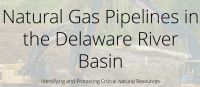
Trout Unlimited’s New Tool For Pipeline Siting Considerations In The Delaware River Basin
|
|
Trout Unlimited, in consultation with a focus group representing industry, state and federal government agencies, and conservation groups, has developed an interactive web-based map to help identify overlapping areas of ecological concern in the Delaware River Basin and surrounding states. Appalachian Basin natural gas continues to be in the news, as production, supplies, power generation conversion, and exports seem to increase monthly. Pipeline projects have also increased as the need to keep up with this resource growth. Eight major pipelines totaling 322 miles are proposed in the Delaware River Basin - if constructed, these pipelines would require a perennial stream crossing every 2 miles and over 9 acres of land disturbance for every mile of pipeline. But along with this resource growth has been a growing concern about environmental and ecological impacts. Water quality degradation from erosion and sedimentation from pipeline construction can occur, and cold-water fisheries may be affected by stream temperature changes from loss of riparian vegetation. Key factors were identified on the new interactive map as cold-water fisheries, water quality, biodiversity, and intact landscapes. Using GIS datasets identifying wild trout streams, public lands, and other important natural resource values, each region was scored as to its relative impact in each category. A final combined score then determined the cumulative ecological sensitivity of area for mapping. Two percent of the Delaware River watershed received the highest cumulative ecological impact scores. Notable areas included Hickory Run State Park and the Lehigh Gorge in northeastern Pennsylvania, Stokes State Forest in New Jersey, and the Upper Delaware River. “This project highlighted special places worthy of protection amid the ongoing buildout of natural gas pipelines in this region,” said David Kinney, TU’s Eastern Policy Director. “These are areas where important ecological resources overlap, and our goal in bringing them to the forefront is to ensure that they are accounted for when industry plans major pipeline routes, and when regulators review them.” TU is working to incorporate this new dataset into agency and industry planning platforms. Project funding was provided by the William Penn Foundation, as well as the Department of Conservation and Natural Resources’ Bureau of Recreation and Conservation, via a grant to the Kittatinny Ridge and Appalachian Trail Conservation Project. The web map can provide guidance in route selection for pipeline industry planners, helping them understand the potential natural resource impacts that would need to be addressed, and for agency regulators, helping them evaluate best practices for permitting and assessments. Conservationists will find the map useful in supporting science-based conversations with industry on pipeline siting. Click Here to visit the interactive map of critical natural resources. For more information on this project, visit the Trout Unlimited’s Pipeline Impacts In The Delaware River Basin webpage. Related Stories: Penn State: Agricultural Production And Shale Gas Development Webinar Nov. 15 Schuylkill Action Network Celebrates 15 Years Of Action Nov. 9 In Reading Deadline Extended: Call For Abstracts For Nov. 29 Academy Of Natural Sciences Delaware Watershed Research Conference; Registration Open POWR, PEC To Hold Regional Watershed Workshops In Butler, Lackawanna Counties [Posted: Oct. 16, 2018] |
|
|
10/22/2018 |
|
| Go To Preceding Article Go To Next Article |