| Share this: | ||||

|

|

|

|

|
|
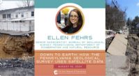
State Museum Of PA Hosts Aug. 16 Virtual Program On How The PA Geological Survey Uses Satellite Data And You Can Too
|
|
On August 16, the State Museum of Pennsylvania will host a webinar on How The Pennsylvania Geological Survey Uses Satellite Data starting at 12:15 p.m. Join Ellen Fehrs, Senior Geoscientist with DCNR's Pennsylvania Geological Survey to learn how satellites can help us address landslides and other hazards, predict the occurrence of caves and sinkholes, and plan fieldwork for our geologists. Plus you will learn how to access this data at home! Presentations begin at 12:15 p.m. and last approximately 20 minutes followed by a question-and-answer session. Click Here to register for this free program and for more information. Visit the State Museum of Pennsylvania website to learn more about exhibits and programs. Visit DCNR’s Bureau of Geological Survey webpage to learn more about the resources and data they have available. [Posted: August 5, 2024] |
|
|
8/12/2024 |
|
| Go To Preceding Article Go To Next Article |